Site Plan for Home Construction: What It Shows, Why It Matters, and How to Get Permit-Ready
Key Takeaway
A site plan for home construction is a scaled overhead drawing showing how your proposed house sits on the property relative to property lines, setbacks, utilities, access, and drainage across the entire lot. Most local building departments require one before issuing a permit. It fixes house placement, previews drainage, and reveals site costs early, while the 2024 IRC references size, location, and distances from property lines as baseline content.

A site plan for home construction is a scaled, overhead drawing that shows how your proposed house and other structures will sit on the property in relation to property lines, setbacks, existing buildings, access, utilities, grading, and site constraints. Unlike a floor plan, it covers the entire property and its surroundings, not just the inside of the house. The exact details and who must prepare it are set by your local authority having jurisdiction. As a reference point, the 2024 International Residential Code model provision asks for the size and location of new and existing construction and its distance from property lines, though the IRC is a model code, not automatically the law everywhere. If you own a lot or are close to buying one, this is the document where your vision meets the realities of your land.
Why the Site Plan Matters Before Construction Begins
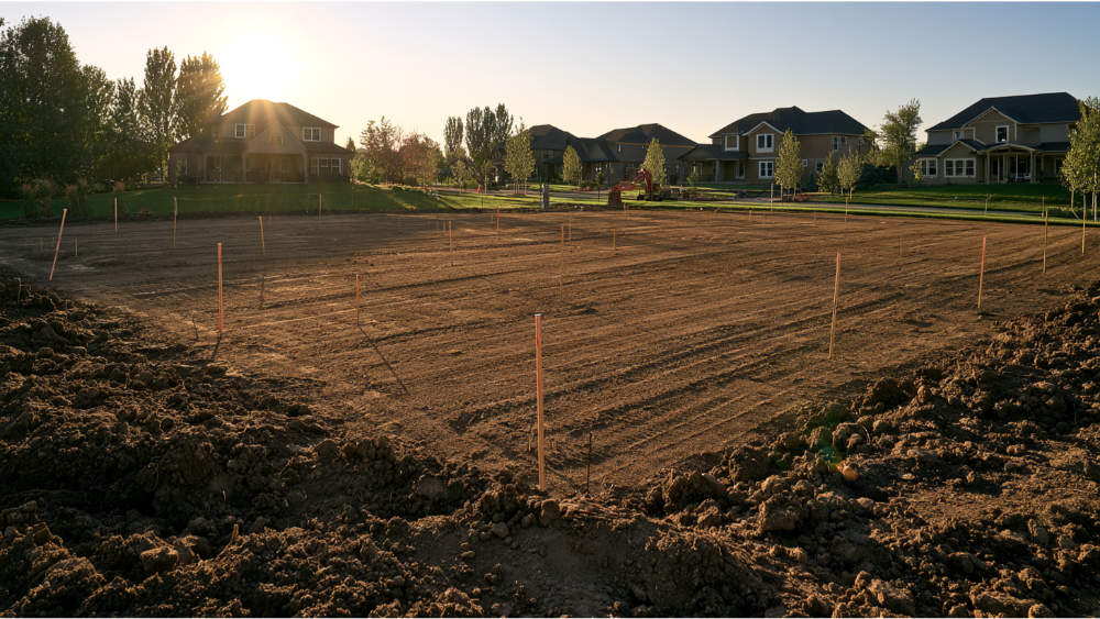
Your site plan is where a dream home becomes a buildable home. It's easy to treat it as one more form in the permit pile, but it's really your earliest chance to catch problems while they're still cheap to fix.
Most local building departments require a site plan before they'll issue a building permit, and the review confirms your project complies with local zoning codes that dictate setbacks, easements, and lot coverage. Beyond approval, the plan does real work: it fixes where the house sits on the lot, previews how water will drain away from the foundation, maps your driveway and easy access, and coordinates where utilities will connect. It also becomes the layout reference crews use to stake the build.
Good siting protects things you care about long after the permit clears:
- Your budget, by revealing site costs early instead of mid-construction
- Your design, by confirming the home actually fits the buildable area of the property
- Your comfort, through orientation, privacy, and drainage decisions made on purpose
Thinking this through up front is how you avoid the expensive redesigns and permit corrections that catch so many homeowners off guard. A clear site plan also gives you the big picture, so every later decision connects back to the land it sits on and you can make informed decisions at each stage.
Site Plan vs. Floor Plan and Other Drawings
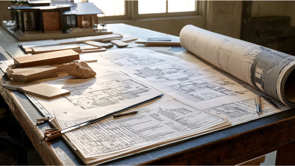
A floor plan shows the inside of the house: room dimensions, wall placement, and how you move through the space. A site plan shows the whole property, including structures, hardscape, landscaping, and utility locations. They answer different questions, and the difference matters because permit reviewers usually want both.
| Drawing | What it shows | When you need it |
|---|---|---|
| Site plan | Entire property: building footprint, property lines, setbacks, access, utilities, grading | Permit submission for most new construction |
| Plot plan | Often similar to a site plan; sometimes a simpler version of the property layout | Depends on the local office |
| Boundary/property survey | Legal property boundaries measured by a licensed surveyor | When accurate property lines are needed |
| Floor plan | Interior room layout and dimensions only | Design and construction documents |
| Grading & drainage plan | Elevations, slopes, and how stormwater flows | Sloped or drainage-sensitive lots |
| As-built survey | Final verified locations of what was actually built | After construction, when required |
One wrinkle worth knowing: some permit offices use "site plan" and "plot plan" interchangeably, while others treat them as separate documents. Ask which they mean. Site plans also come as a flat 2D drawing, a flat view of your parcel, or as 3D renderings, and a 3D view can make it far easier to picture how your house and your land relate before anyone breaks ground.
What Does a Residential Site Plan Include?

Every site plan shares a core set of information, but a flat infill lot and a sloped, flood-prone property need very different levels of detail. Separating the universal basics from the conditional details keeps you from over-drafting or under-drafting.
Core Property Boundaries and Drawing Scale Every Site Plan Shows
- Property lines, property boundaries, and lot dimensions
- A north arrow and a clear drawing scale
- Street frontage and site access
- Existing and proposed structures, including other structures already on the lot
- The building footprint, including roof overhangs, and any secondary building footprints
- Required and proposed setbacks, plus distances between structures
- Easements
- Driveways, walkways, patios, parking spaces, a fence or fences, and other hardscape
Conditional Details Like Fire Hydrants and Landscaped Areas (Only When They Apply)
- Existing and proposed elevations
- Contours, grading, and drainage direction
- Retaining walls
- Utility routes and connection points
- Fire hydrants and other emergency access features
- Well, septic tank, and drain field locations
- Flood zones and base flood elevations
- Protected trees, landscaped areas, green spaces, and natural features
- Streams, wetlands, slopes, and required buffers
- Erosion-control measures
- Lot coverage or impervious-surface calculations
Utilities deserve a note of their own. Marking water, sewer, and electric routes isn't just paperwork; it helps crews avoid hazards during excavation. Easements matter too, because they give utility companies access and can restrict where you're allowed to build. Landscaping and a perimeter fence may feel like afterthoughts, but on tight lots they interact with setbacks and easements, so reviewers often want them shown. The precise list is always jurisdiction- and project-specific, so the local checklist is the final word.
How the Site Plan Affects Your Design and Budget
Where you place the house drives a surprising share of your construction cost. Move the footprint ten feet in one direction and you can change how much you excavate, how your foundation is designed, and whether you need retaining walls.
Placement touches almost every line item that follows:
- Excavation, fill, and foundation design
- Retaining walls and drainage work
- The length of utility and septic runs
- Driveway construction, fence lines, and tree removal
- Outdoor living areas, landscaping, and room for a future garage, addition, or ADU
Orientation shapes how the home feels day to day. Positioning it thoughtfully for sunlight, prime views, and prevailing wind affects comfort and energy use, while grading that directs stormwater away from the foundation protects the structure for decades. If a new pool, a new deck, or other structures are on your wish list, showing them early on the site plan keeps them from colliding with setbacks and land use limits later. For owners thinking about rental income or family housing down the road, reserving space for an ADU on the original site plan is far simpler than retrofitting the idea later. Smart siting is quality and affordability working together, not one traded against the other.
How a Site Plan Is Created, Step by Step

The process moves from what the property already is toward what you want it to become. It is a fairly straightforward process once the right data is in hand, and here's the order that keeps everything coordinated and helps you create a plan that actually clears review:
- Gather the deed, recorded plat, any existing survey, and property records.
- Confirm property boundaries, easements, and rights-of-way. A boundary survey from a licensed land surveyor establishes the legal property lines with exact dimensions.
- Review zoning, setbacks, lot coverage, and any overlay districts.
- Evaluate topography, soil, drainage, flood risk, and access to the surrounding area.
- Place the proposed house and related improvements on the buildable area, then set the overall property layout.
- Coordinate utilities, septic or sewer, driveway, fencing, and grading.
- Confirm the local drawing scale, stamp requirements, and submission format, and double check the numbers against the survey.
- Prepare and submit the permit-ready plan.
- Address any review comments from the building department.
- Keep the approved documents on-site during construction, and submit amended plans whenever the work changes.
Step four is where federal screening tools earn their keep. FEMA's Flood Map Service Center lets you check whether a lot sits in a Special Flood Hazard Area, defined by the base flood that has a 1% chance of being equaled or exceeded in any year. USDA's Web Soil Survey flags broad conditions like depth to water table, slope, and foundation limitations. USGS elevation data gives you a rough read on slope. Treat all three as early feasibility checks, not survey-grade precise measurements.
Who Prepares a Professional Site Plan for a New Home?
There's no single answer, and anyone who tells you there is probably doesn't know your jurisdiction. The right preparer depends on your lot and your local rules.
- Homeowner: for simple projects where the office accepts accurate, scaled drawing work that is self-prepared
- Drafter or residential designer: for clean, permit-ready drawings on straightforward lots
- Architect: for custom design that integrates the house and the site
- Land surveyor: when accurate legal property boundaries are required
- Civil engineer: for grading, drainage, and complex site work
- Landscape architect: for significant site and planting design
Lean toward a professional site plan when the lot is complex, boundaries are unclear, or you're dealing with slopes, drainage, flood exposure, or a septic system. New ground-up construction almost always warrants it. The 2024 IRC notes that construction documents must be prepared by a registered design professional when the jurisdiction's laws require it, and your building official can require it for special conditions. Rather than juggling a separate surveyor, drafter, designer, and builder, an integrated team of designers and contractors with real design experience can coordinate those roles under one roof, so nobody's work falls through the gaps between handoffs.
Can You Create a Site Plan From an Online Map or Template?

You can, for early thinking. We'll be honest about where that ends.
Online maps, aerial imagery, assessor parcel maps, and site plan templates are genuinely useful when you want to start drawing a first hand drawn sketch and visualize options for a new project. A quick online search or the right website can turn up a usable base image, and online drafting services can produce a detailed map at lower cost than a full professional engagement. But there are hard limits. Assessor parcel lines are not legal boundary determinations. Free elevation tools are not survey-grade; USGS itself states that point elevations from its query service are interpolated and should not be treated as official surveyed values. Many permit offices require a current survey or professional certification before they'll approve.
DIY work and site plan templates save money, and they can also get rejected, which costs you more in delay than you saved. The one rule we'd never bend: never place construction near a property boundary based on an online map alone. Templates help you think. Verified data that reflects local regulations and local requirements is what gets you approved.
Common Site Plan Mistakes That Delay Permit Approval
Most rejections come from a handful of avoidable gaps:
- Using an outdated survey that doesn't show current improvements
- Missing dimensions or setback distances
- Not clearly distinguishing existing work from proposed work
- Omitting roof overhangs, stairs, decks, fences, or equipment pads
- Leaving out easements and rights-of-way
- Showing no drainage direction
- Relying on unverified parcel boundaries or guessed property lines
- Submitting the wrong drawing scale or file format
- Leaving utilities or septic components unresolved
- Designing the house before confirming it fits the buildable area
Because each city sets its own submission rules, the single best move is to pull the project-specific checklist from your building or planning department before you draft anything. A quick example: one county may require fire hydrants shown within a set distance of the driveway, while the next county over never asks for them, so the checklist is what tells you which details your drawing needs. Most cities publish these checklists online, which makes them easy to track down before any permit applications go in.
What to Gather Before Your First Design Meeting
 You don't need to have every answer. You just need to walk in with the facts that let a team help you fast. Bring what you have of this list:
- Property address and parcel information
- The deed and recorded plat
- Any existing survey or drawing of the property
- A preliminary wish list for the home and its layout
- Preferred orientation and the views you want to capture
- Garage and driveway requirements
- Outdoor-space and landscaping goals
- Any plans for a future addition or ADU
- Known utility information
- Your target budget and timeline
- Any notices or checklists from the permit office
Showing up with these turns a daunting first meeting into a productive one. You stay in control of the conversation instead of feeling lost in it.
How an Integrated Design-Build Process Keeps It All Aligned
When one team carries your project from site analysis and drafting through permitting and construction, there are fewer gaps where things get dropped or re-explained. Site-cost risks surface earlier, while there's still room to adjust the design. And when a site condition or a design choice shifts, you hear about it from the people responsible for the whole picture, not from a chain of separate specialists pointing at each other.
That coordination is also where honesty becomes practical. You get a clear picture of how your house relates to your land through 3D visualization before construction starts, you're part of the key placement decisions, and you're never left guessing who owns what. At Skyline Design Build, we work this way across the Greater Sacramento area and the San Francisco Bay Area as a single integrated firm, so the plan that gets drawn is the plan that gets built.
Start Your Project With Confidence
A complete, verified site plan protects your vision and your investment at the same time. It's the clearest early signal that your dream home can actually be built where you picture it. If you're ready to take that first step, we would love to join you in your unique project. Schedule your free consultation by calling (916) 701-9196 in Sacramento or (415) 480-4607 in the Bay Area, emailing [email protected], or reaching out through our website contact form.
Frequently Asked Questions
How do you make a site plan?
Start by gathering your property records and an existing or new survey, then confirm your property boundaries and setbacks. Place the house on the buildable area, coordinate utilities and drainage, and confirm the local drawing scale and submission format before you submit to the permit office. For new construction, a professional site plan is often needed to create accurate, compliant documents the reviewer will accept.
What is 30%, 60%, 90% design?
These are design-completion milestones. At 30%, you've settled the concept, overall layout, and major placement decisions. At 60%, systems are coordinated and details are refined. At 90%, documents are near-final and permit-ready, awaiting final review. The percentages are a simple way to track how far a project has progressed toward construction.
What size house can you build for $250,000?
There's no universal square-footage answer. Size depends heavily on your location, lot conditions, site work, finishes, and local construction costs. Site planning plays directly into this, because where the home sits on the property drives excavation, utility runs, and drainage expenses. The most reliable way to get a realistic estimate is a consultation about your specific lot and goals.
What are the five key features of a site plan?
Most residential site plans center on five things: property lines and dimensions; a north arrow and drawing scale; existing and proposed structures with the building footprint; setbacks and easements; and utilities, access, and drainage. The exact required features vary by jurisdiction, so confirm the checklist with your local building department.